Remy Monsen | April 5, 2018 | Campaign Cartographer, CC3 Plus, update
Update 16 to CC3+ just released (get it from your registration page), and with it comes a long list of added commands and fixes. Let us have a look at those new commands, and discuss how to use them in your mapping efforts.
I’ve divided this post into two different sections. The first part describes the new features that are useful in your mapping, while the second describe the more technical commands. I recommend you give both sections a view, but many users will probably want to just glance over the technical section and see what is relevant for them.
Do note that all the new commands in this update is presently only available as command line commands, which you must type manually on the CC3+ command line, they are not available in the menus or toolbars yet. Don’t let this discourage you however, as using a command from the command line is just a case of typing in the command on your keyboard and hitting enter (as long as you are not currently in the middle of another command). The rest is just doing as the command line tells you, which you should be familiar with from many other commands already.
The Fun Stuff
Contours from raster images
So, let us start with one of the more exiting additions to CC3+. Previously, if you wanted to import a map you had drawn in another program into CC3+, you would have to import it as a background image, and then manually trace over it with the drawing tools to recreate the map in CC3+, as there was no way for CC3+ to generate proper drawing entities from your image, such as landmasses.
However, with the new CONTOURSM command, this has changed. To start out with expectations for this command, what this command does is to find edges in your image, where edges are defined as transparent vs non-transparent pixels. This makes it a nice command to automatically convert an image of a landmass into a CC3+ polygon, but it is not a general solution for converting any kind of image and get all the details converted to CC3+. So, what this command mainly does is that it saves you from manually tracing the outline of your landmass. For anyone who have done this with a complicated landmass, they should quickly realize how big of a time saver this is.
So, to explain the use of this command, here is a brief mini-tutorial on its use. I will take an image of an island and turn that into a proper CC3+ editable drawing entity.
Note that even if this tutorial uses a landmass as an example, the use of this command is not limited to landmasses.
-
- Before we begin in CC3+, we need an image of our landmass. I’ve used the below image for this. However, as I mentioned above, CC3+ detects the edges based on transparent vs non-transparent pixels, so I can’t just insert this image. I need to edit it in an image editor first, and make the seas transparent and the landmass a solid color. Since this is a CC3+ tutorial and not a tutorial on image editing, I won’t go into the details here, but generally you should be able to just load the image into your favorite image editor, and then use the magic wand or similar selection tools with a reasonable tolerance to select sea areas and make them transparent. The second image below shows my landmass after this process.


Continue reading »
5 Comments
Simon Rogers | November 21, 2014 | Campaign Cartographer, CC3, development
The next version of Campaign Cartographer, CC3+, is in late beta. We were hoping for a release this year, but that’s looking less likely. You can read about the new version here. 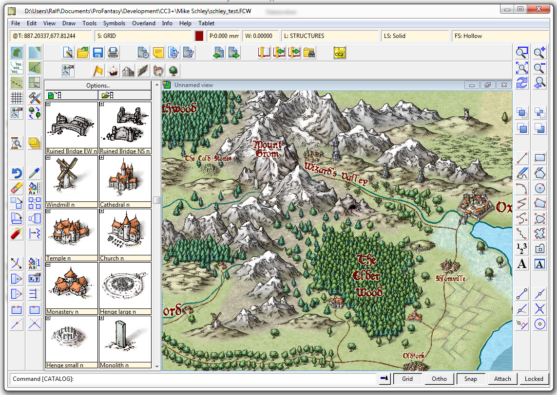
We’ve got two show-stopping bugs to deal with before we release the CC3+ beta to a wider audience.
Who is this audience?
We released Character Artist 3 this time last year, and until 1st January 2014 offered free CC3+ upgrade protection to purchasers. Character Artist 3 users will be able to download the beta version and give us feedback as soon as our two big bugs are dealt with. It’s impossible for us to tell when that will be, but I hope it’s in the next couple of weeks. If you are in this category, we’ll send you an email, and update your registration page with the new version. When the new version is finished, you’ll get a new update.
When this wider beta test is completed, we’ll release the upgrade, but we absolutely don’t want to release it until we are sure it’s solid on all operating systems.
15 Comments
Clercon | January 22, 2013 | Annual, Campaign Cartographer, overland, Par lindstrom
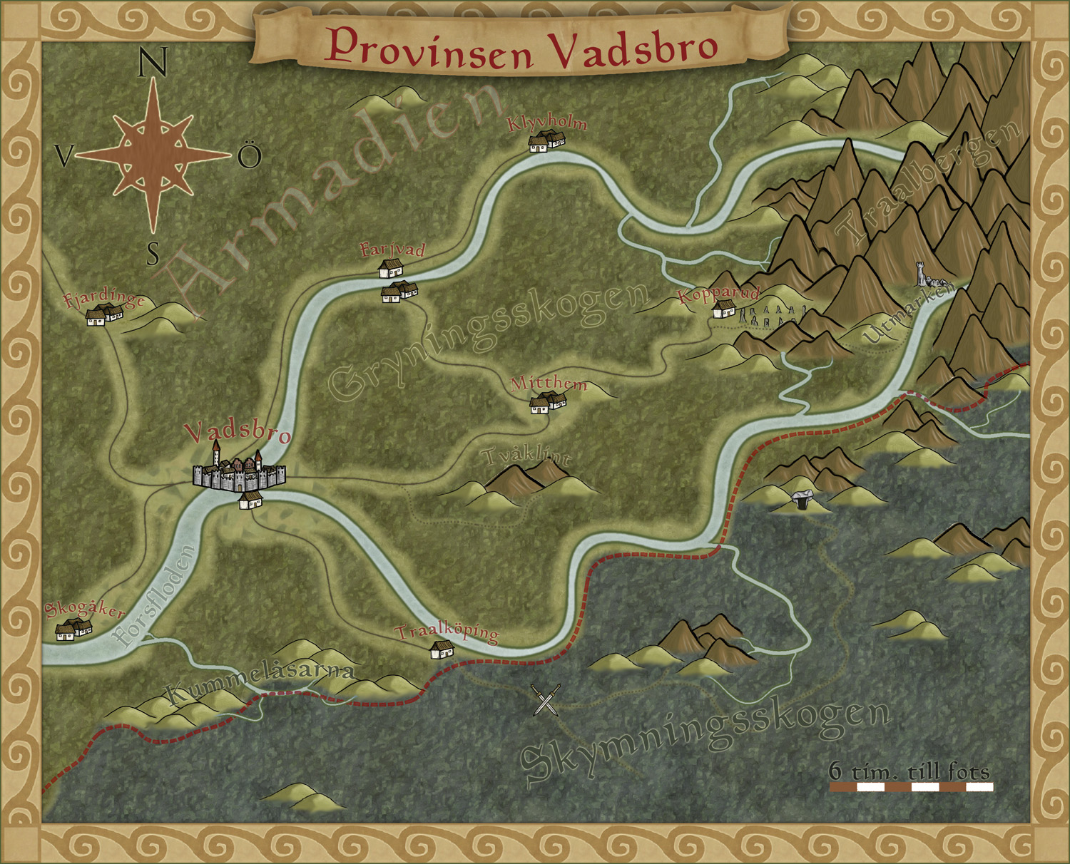
To get more ideas for maps to do I’ve decided to make a fantasy adventure. First of all I need a campaign map of the area where the actual adventure will take place, with that one in place it will be easier to plan the other maps I need to draw.
To make the map I decided to use the style I made for the December issue of the Annuals from Profantasy. The style was made for creating campaign maps for smaller areas, so it will fit very well for this map.
The adventure will take place in the country Armadien, close to a city called Vadsbro (Littlebridge in my Armadien map). Vadsbro is situated close to the Armadien border, next to the Traal infected Skymningsskogen (dusk forest) and the Traal mountains, so there will be a lot of forest in the map.
As soon as I started on the map I realized that I had to improvise a bit with the style. The main feature in the map, except for all the forest, is the river that split up in two rivers closer to the mountains. The rivers in the style aren’t really suited for depicting a main river in this scale, so I decide to use the ocean texture for the rivers. In this way the river will look more like the dominating natural feature in the area.
The river tool however comes in handy to show smaller rivers connecting into the main branches, but I had to change the colour of the rivers to blend in more with the main rivers. When I created the style, which is based on my Truscian map, I wanted the rivers in a darker colour and the ocean in a lighter one. That works very well if you do a more zoomed out map. But if you zoom in closer to an area for a map, and you suddenly want to use the ocean textures as rivers, the colour for the river tools don’t really blend in. So I decided to change them.
It is actually quite funny how a style you’ve created yourself, suddenly needs to be trimmed when you start working with it. But I think you can say that for all styles. At least I always trim the styles so they’ll fit into my way of working.
Now that the map is done it will be easier to decide what more maps I need to do. You can say that I’m making my adventure from the maps, the story I have so far will probably change a bit with every map I make. But that is the fun part of mapping, to weave a story around your maps instead of making maps from your story.
Originally posted on mappingworlds.wordpress.com
1 Comment
Clercon | May 31, 2012 | Campaign Cartographer, overland, Par lindstrom, Tutorial, wielink

This time I thought it was time to make a tutorial on how you can make a convincing overland map. This will be more of an overview tutorial on how I think and plan when I make a map, so it won’t be very technical. This means that you can use this tutorial regardless what program you use when you map, even though I in the tutorial will use a map made in CC3 as a reference and example.
The first thing to take into account when you start an overland map is the landmass. How much of the map will be water and how much will be actual land? This is probably the most important step in your map because it will set the boundaries for what the end result will be. So already here I’m having a quite clear view of where I want to go with the map, shall the map be land based, island based or something in between.
Below you see my map “Sagorike”, that I’m using as an example in this tutorial, with only the landmass viewable. I’ve also written some things on the map that you can have in mind while drawing the coastline.
A good thing to do before starting on your landmass is to look at the real world (Google earth is great for this). If you want a lot of fjords, have a look at Norway, Island based, look at area outside Stockholm for example, and so on. It is always good to find inspiration in the real world. It will make your map look more believable, and believable maps tend to look good.
However when I make maps of worlds the most important thing for me is that they look good and in some part convincing. It doesn’t matter if the world doesn’t work geologically or physically, as long as it looks convincing. To make it look convincing you have to get the things right that the majority of people can spot, like rivers, they will NEVER split downwards, lakes, there is always only ONE outflow, or deserts, make sure that you place them in a way that it looks probable that no rain will get there, and so on. If those small details are correct it is more likely that the viewer will believe in the whole map, regardless if everything in it is possible according to our physical laws or not.
That is all for now, in the next post we will start by placing the mountains in the map.
(Originally posted on mappingworlds.wordpress.com)
3 Comments
Clercon | May 16, 2012 | Annual, Campaign Cartographer, CC3, Overland map, Par lindstrom

I’ve started to play a simple and easy to understand roleplaying game with my two oldest children (this is also the reason that the names in the map are all in Swedish, they don’t read English). And of course no game can be really appreciated without a world map to look at.
So I decided to make one while trying out the April annual style from Profantasy, made by the artist Herwin Wielink.
It is always hard to start working with a new style, it takes a while just to get used to the style itself. What graphics are included, fields, desert, marshes, rivers, forests and so on. A good thing is to just create a couple of test maps to get used to the style, to get the feeling of it. In this case I did that, but not only on purpose. I’ve read on a lot of places that people complain that CC3 can be a bit unstable, that it sometimes crashes a lot.
Well I’ve never experienced that, apart from with one of my more ambitious projects where the actual file grew too large for CC3 to handle. But with this particular style I actually had two crashes where I had to restart the whole project from the start again. That has never happened before and it was probably just a coincidence that it happened now, but I guess that the end result ended up better because of this. You can say that I learned from the mistakes in the two earlier maps, so I didn’t need to repeat them in the final map. [Editor’s notice: If you ever lose your map, look for autosave.fcw in your CC3 folder.]
The graphics in the style are absolutely gorgeous and mountains, forests and other symbols really melt into the background in a great way that kind of hides the fact that the map is made in CC3. The only other CC3 style I can think of that accomplishes this as good as this one is the 2011 March annual overland style by Jonathan Roberts.
I also like the colour palette a lot in the style. Sometimes I think that maps made in CC3 can be bit cartoonish when it comes to colour, this particular style though has a really nice dark feeling about it. I like that.
Overall the style was very easy to use, the selection of textures and symbols are vast so you can really get some great variation into the map. And variation is very good if you want to make a map that is unique and nice to look at.
As usual I’ve done the labeling in Photoshop, I just can’t get it to work satisfactory in CC3, but that is probably because of me and not the program. The font is the same though as the one included in the style.
(Originally posted on mappingworlds.wordpress.com)
5 Comments
ralf | December 16, 2011 | Campaign Cartographer, Fractal Terrains, overland
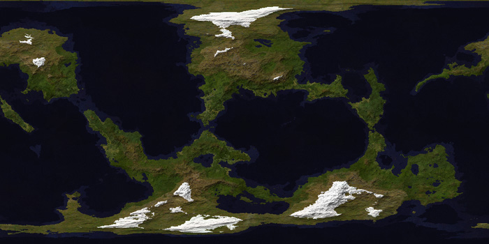
The final Annual issue for 2011 is here: A combined texture pack for Fractal Terrains 3 and Campaign Cartographer 3. Give your FT world a new look with the textured climate shader or draw climate maps of your regions in CC3.
Stay tuned for the Cartographer’s Annual 2012!
Comments Off on Final Annual – Climate Textures
Mark Fulford | May 27, 2010 | Campaign Cartographer, Game Design
Writer, game designer and award-winning potato salad maker Robin D Laws has written three posts about how he uses Campaign Cartographer 3. This is the first:
Campaign Cartographer, the Writer / Designer’s Friend
Part 1 – Better than the hideous scanned-in scrawl
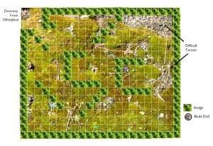 Here’s a paradox for you. I consider Campaign Cartographer an indispensable tool of my work as a game designer and writer and use it on a regular basis. I am at the same time a lousy mapper. When I see the gorgeous maps produced by Profantasy’s cadre of dedicated mapmakers and by its fan community, I am reduced to fits of envy.
After all these years of using the program, I lack mapping chops because I only infrequently use it for its intended purpose. Instead, I’ve press-ganged it into service as an outlining tool. I use it to create product mock-ups, build diagrams for game books, and, most of all, visually organize my thoughts when plotting fiction projects.
Continue reading »
1 Comment
Mark Fulford | May 27, 2010 | Campaign Cartographer, Diagrams, Game Design
Campaign Cartographer, the Writer / Designer’s Friend
Part 2 – Moving stuff around
by Robin D Laws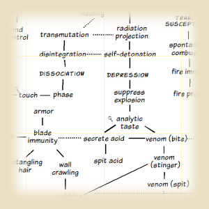
CC3 offers the primary benefit of a CAD-based illustration tool in a gamer-friendly form. Whether creating a map or using it for any of the purposes I’ll discuss below, that benefit is ease of editing. It lets you think visually, by allowing you to easily and continually manipulate its various elements. Changing either an element or its position relative to others proves blissfully easy.
When sketching out an encounter map for publication, you’re always going to realize midway through that you need to make an adjustment—you’ve left a tactical bottleneck at the entrance, placed a trap where it won’t get tripped, or given a confusing position marker to a creature. You can move stuff around in Photoshop or one of its equivalents, but it’s a pain. On paper, forget about it. Moving stuff around is what CC is all about—for me at least. Continue reading »
2 Comments
Mark Fulford | May 27, 2010 | Campaign Cartographer, Game Design
Campaign Cartographer, the Writer / Designer’s Friend
Part 3 – Developing fiction
By Robin D Laws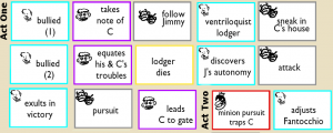
Outlining a work of fiction is also about moving stuff around. Some writers prefer to hit the page and start writing, and then sort out the structure during subsequent revision rounds. Personally, I need to have the narrative line worked out in some detail before the first draft starts. Minor transitions and obstacles are often stronger if you think them through on the day, but the broad sweep has to be in place. (Outlines are also essential when you’re working with an editor who has to sign off on your story before you start writing in earnest.)
Plotting never gets easy. For me, it typically starts with a few key situations or images. Then I bash around on a scratch document in which I trawl for some kind of unifying spine. During this phase I ask myself the defining questions shaping the story I’m about to assemble. What is this story about, in a single sentence? Who are my characters? What drives them, and to what actions? Continue reading »
3 Comments


