ralf | July 23, 2024 | community, Community Atlas Project, competition
 Remy Monsen has been managing the amazing Community Atlas project for such a long time now, that the collection is getting close to 1000 maps! All free for you to use in your own game, if you want. To celebrate this milestone Remy has announced a mapping competition which ProFantasy will support with prizes! You can find all the rules and information on participating in the competition here: Community Atlas 1000th map Competition
To say it in Remy’s word: “Please don’t think you have to be a master mapper to compete. A competition is a great way of testing yourself and have some fun. Everyone is welcome here, and while some of the prizes are dedicated to the best maps, there is an option for anyone who competes to win.”

Comments Off on Mapping Competition: 1000 maps in the Community Atlas
ralf | September 5, 2022 | competition, Floorplans
 Remy Monsen ran a mapping competition during the month of August, and some amazing building floorplans were created by the community.
The challenge was to create floorplans for a set of buildings chosen from one town map (see on the right) of the community atlas project, with the finished maps (hopefully) becoming part of the atlas and complementing its wonderful collection of free content.
It’s time now to vote for the winners, so head over to the community forum to chose your favourite in two categories.
Comments Off on August Mapping Competition: Voting for your Favourite Maps
ralf | March 4, 2021 | atlas, Community Atlas Project, competition
 The submission period for the mapping competition celebrating the 500th Community Atlas map (and 4th year anniversay) is now over. 18 competitors have submitted 30 awesome maps, and you can help decide who wins the prizes!
Head over to the community forum to see all the entries in their full glory and vote on which three you like best. Voting is open until March 9th.
Best of luck to all participants!
Comments Off on Atlas 500th map Competition – Now open for Voting!
Remy Monsen | January 8, 2021 | CC3 Plus, Community Atlas Project, competition
 The community atlas is almost at it’s 500th map, and will also be 4 years old this February.
For this occasion, we are having a mapping competition with the chance to win some nice voucher to use on ProFantasy products.
You can read all the details about the competition in this forum post, but the main idea is to create a dungeon with either a ice and/or fire theme.
There will be prizes for best map, and also a prize drawn at random from the submitted maps for the 500th map.
This contest is intended for every CC3+ user, no matter their skill level. Don’t hesitate to join even if you don’t feel your artistic skill can compete with the best. Even if you don’t win any of the prizes for best map, there is also the random draw which anyone could win.
The contest will be running until the end of February. Please head over to the forum post to check the exact details, ask any questions you might have, and have a look at the two maps already submitted.
Please, join in on the competition. It is great fun participating, no matter your skill level, and it is a great opportunity to challenge yourself, maybe do something different than your usual fare. And the more people who participates, the better the contest becomes.
1 Comment
Simon Rogers | October 11, 2016 | community, competition, Floorplan, forum, user maps
To celebrate the 35th Anniversary of her gaming group forum user Shessar hosted a map-making competition on the forum. You can see all the entrants and the rules here on the forum thread.
Here are the winners.
Bill – The Journey Begins (3rd place)
This is a perfect vehicle for miniatures when printed out at a suitable scale.

2nd – LoopySue – Henge Portal
I love the lighting in this, which provides a sense of mystery and foreboding.

1st – Monsen – Breaking Through
This map cleverly combines the mundane modern with the archaic and occult.

Here are a couple of others which show techniques I particularly like – this shows a great use of outer glow and bevel effects on the walls, as well as glows from the symbols.

This demonstrates CC3’s lighting features, and a variety of pallets to contrast the different areas

Comments Off on Shessar’s Battlemap Competition
ralf | July 15, 2014 | competition, lairs
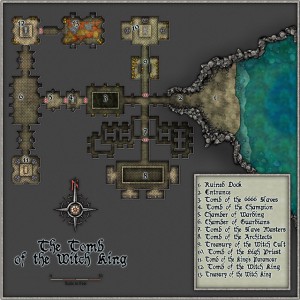 We are very happy to announce the winners of our recent “Lairs” competition. This time we asked Annual contributor and accomplished fantasy cartographer Pär Lindström to be our judge. Here’s his verdict:
I was asked by Simon to be the Judge in the latest competition (April to June 2014). I gladly accepted, and actually felt quite honoured that he asked me.
First of all I must say that I am impressed by the overall quality that the community has, and selecting one winning piece wasn’t an easy task.
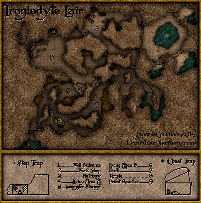
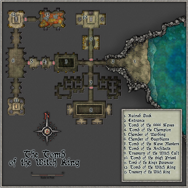
When deciding which map I thought was the best I looked for what I would have liked to see in an adventure. That didn’t really make the choice easier but after having looked at the maps for a long time there were three maps that kind of stuck out. The Tomb of the Witch-King, the Necromancer’s lair and the Troglodyte lair.
And in the end, having to choose between three very good maps, I decided for The Tomb of the Witch-King as the winner. What I really like with that map is the general layout, the flow of the map. Also the water makes a very good contrast to the rest of the map which makes it catch your eyes. When I look at it I really want to use it for my players to explore, which usually is my children, and maybe having them fight a skeleton or two.
Congratulations to our winner Gary Barker (Raiko), who receives an Unlimited Patron License, meaning he’ll be automatically getting any past and future Campaign Cartographer-related ProFantasy products for free.
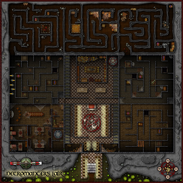
And not to forget the runners up: Oliver Piotrowski (o1i) with For his Necromancer’s Lair and Flavio Hickel (anomiecoalition) with the Troglodyte Lair. They each win a $100 voucher for the ProFantasy web store.
Thanks to all participants for your amazing work!
-

-

-
Troglodyte Lair
-

-
Necromancer’s Lair
ralf | June 27, 2014 | competition, lair
Here is the list of entries for the latest ProFantasy competition, entitled “Lairs”. We announced it to celebrate the release of Symbol Set 4: The Dungeons of Schley and Simon’s brief went as follows:
Create a small underground lair – a bandit hide out, a cave taken over by a dragon, a mine used as a cultist HQ. The whole area the map covers including map embellishments should be no more than about 100 m / 300 ft square. The best will win an unlimited patron license to all our cartography software forever; two runners up will receive vouchers.
– It can be in any style, past, modern or future.
– You have to create it with CC3, and any other ProFantasy map-making software you wish to use – annuals, symbols sets, whatever you like,
– It can include third-party art as symbols or fill styles long as that art is available for commercial use by anyone.
-

-
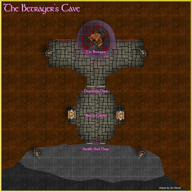
The Betrayer’s Cave
-

-

-
Troglodyte Lair
-

-
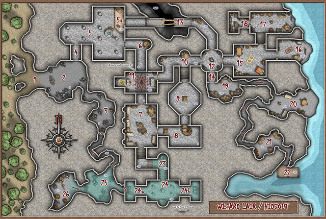
Wizard’s Lair
-

-
Underground Fort
-

-
Necromancer’s Lair
-

-
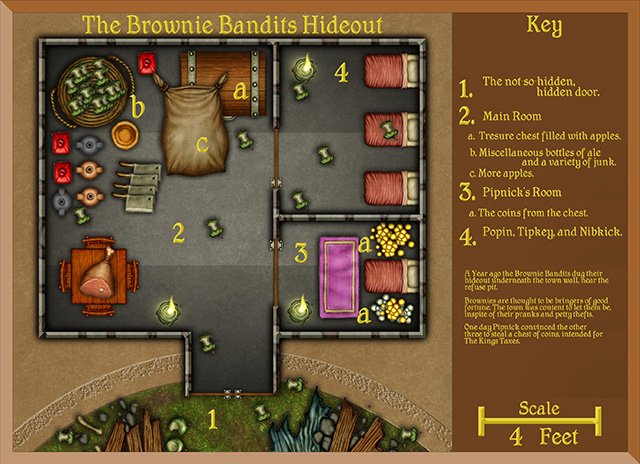
Brownie Bandits’ Hideout
-

-
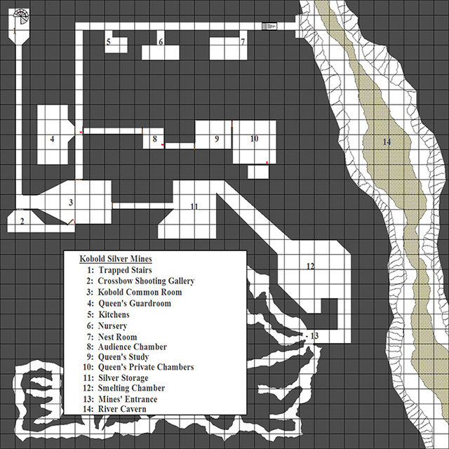
Kobold Lair
-

For large-scale versions of the competition maps, click on the images below.
#1 Troglodyte Lair
#2 Tomb of the Witch-King
#3 The Betrayer’s Cave
#4 Kobold Lair
#5 Brownie Bandits’ Hideout
#6 Necromancer’s Lair
#7 Underground Fort
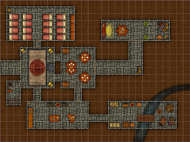
#8 Wizard’s Lair
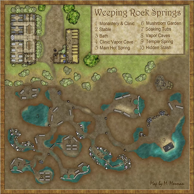
#9 Weeping Rock Springs
Comments Off on “Lairs” Competition Entries (June 2014)
Simon Rogers | April 14, 2014 | competition, dungeon
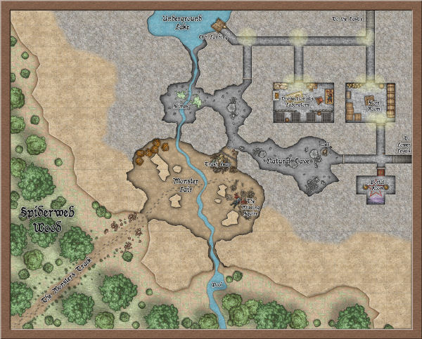 To celebrate the release of The Dungeons of Schley, we’ve devised a competition. Create a small underground lair – a bandit hide out, a cave taken over by a dragon, a mine used as a cultist HQ. The whole area the map covers including map embelishments should be no more than about 100 m / 300 ft square. The best will win an unlimited patron license to all our cartography software forever; two runners up will receive vouchers.
- It can be in any style, past, modern or future.
- You have to create it with CC3, and any other ProFantasy map-making software you wish to use – annuals, symbols sets, whatever you like,
- It can include third-party art as symbols or fill styles long as that art is available for commercial use by anyone.
- You grant us permission to post the map online, though you retain all other rights.
- Only one entry per person
- The main prize is an unlimited patron license, and the two runners up will receive $100 vouchers.
- To submit, post your entry on this forum thread.
- Competition closes on 14th June 2014.
1 Comment
ralf | April 1, 2014 | Annual, competition
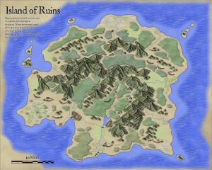
Following our map-making competition, we asked the winner Christian, whether he would allow us to transform his beautiful island map into a new style for the Annual. He happily obliged us, and the April issue is the result of that. Titled “Volcanic Islands” in honour of the competition, the style of course allows to draw all kinds of islands or regions and especially suited for small to mid-sized areas. Check out the example map on the right (click for an enlarged version).
The April Annual is now available from the registration page for current subscribers. If you haven’t subscribed yet, you’ll find more information on the Annual 2014 product page.
Comments Off on Cartographer’s Annual – April: Volcanic Islands
ralf | March 19, 2014 | competition, user maps
We’ve asked Christian, the winner of our map-making competition, to share a few words on his map and the competition and he was so kind to oblige. Here’s what he has to say.
* * * * *
A few weeks ago I was searching online for fantasy map-making contests. I wanted an assigned theme and a real deadline—something that would challenge my skills and help me generate another piece of work I could be proud of. That’s when I came across ProFantasy.com. I’d been interested in their software before, but hadn’t had a chance to use it. Now I had a chance to win it in a competition.
Make an island, they said, about three miles across. Something like a medieval treasure map. The contest had been open for months, but was closing in just a few days. I took a look at the submissions that had been sent in thus far, decided I had a shot at winning, and threw myself into it.
I worked feverishly, right up to the deadline, and actually ran out of time to put absolutely everything I wanted into the map. That’s why there’s no border around it, and no compass rose… But what I did manage to produce followed my vision. As a novelist and dungeon master, I knew I could create some storytelling elements that would hook into the drawing. Some secrets and clues that would only be available to those who looked closely, and a narrative that would marry the image to the text. I had an aesthetic that I’d been developing for maps for my novels, inspired by some of the top fantasy cartographers online. I’m passionate about making beautiful illustrations, and I’m excited to be learning new techniques every day.
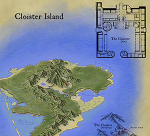 * * * * *
As for the hands-on process itself, virtually all of this map was hand-drawn in ProCreate on an iPad 3 using an Adonit Touch stylus. There are a few “pattern brushes” in that app which help with things like the the jungle trees and the ocean waves, but everything else was the result of pushing pixels manually. The shape of the island and mountains isn’t based on anything other than doodling with the idea of a vaguely volcanic tropical island in mind.
The cloister overhead plan was laid out in Adobe Illustrator. It’s far larger, sharper, and more detailed in the original file, with many upper floors and basement dungeon levels. The “3D” isometric extrusion of the cloister is actually just faux-3D, a technique I use in Illustrator where I take the overhead plan and rotate, squash, duplicate and move by a certain amount, and then blend. I took a screen shot of that and traced over it in ProCreate.
The last step was to bring it all into Adobe Photoshop. I had created a “parchment background” from some rendered clouds and a bunch of filters, so I laid out the various pieces on that background and added the text elements. Then I did save-for-web and picked settings that looked good but kept the resulting file under 2 MB.
The cloister itself is about 300 feet on one axis, making the hypotenuse around 500 feet. Since you can line up 30 of the little cloister images end to end and have them stretch from one side of the island to the other, the island winds up being about 3 miles across.
1 Comment
 Remy Monsen has been managing the amazing Community Atlas project for such a long time now, that the collection is getting close to 1000 maps! All free for you to use in your own game, if you want. To celebrate this milestone Remy has announced a mapping competition which ProFantasy will support with prizes! You can find all the rules and information on participating in the competition here: Community Atlas 1000th map Competition


 To celebrate the release of The Dungeons of Schley, we’ve devised a competition. Create a small underground lair – a bandit hide out, a cave taken over by a dragon, a mine used as a cultist HQ. The whole area the map covers including map embelishments should be no more than about 100 m / 300 ft square. The best will win an unlimited patron license to all our cartography software forever; two runners up will receive vouchers.
