Simon Rogers | May 19, 2014 | historical
ProFantasy’s Software allows you to create a wide array of maps in historical styles, from Mercator to medieval strip maps. This article shows examples and lets you know which software is required in addition to CC3 to create them.
If there are any historical styles you’d like us to match, let us know in the comments.
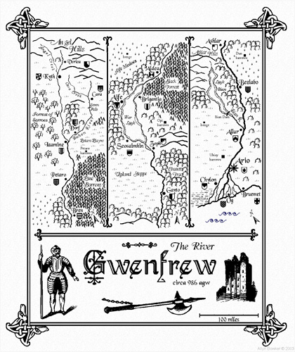
This Mercator-style map captures the flair and style of 16th and 17th century hand-coloured maps. Those centuries – the so-called “Age of Exploration” – were an era of immense European exploration and expansion and the art of cartography flourished to document and publish the newly discovered information on the shape of the world.
This map was created with the Mercator Historical Style from Annual Vol 1.

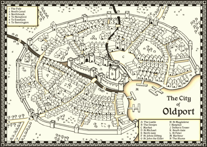
This map emulates the famous town and city maps of British cartographer John Speed (1542-1629). It was created with the John Speed City style from The Cartographer’s Annual Vol 1.
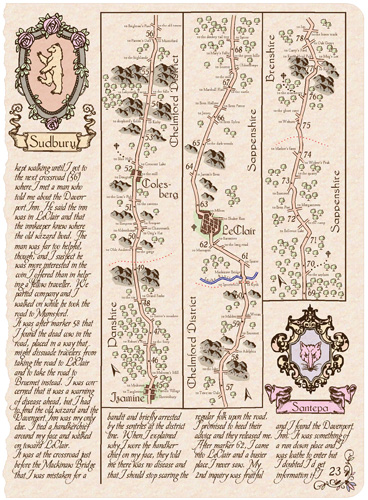
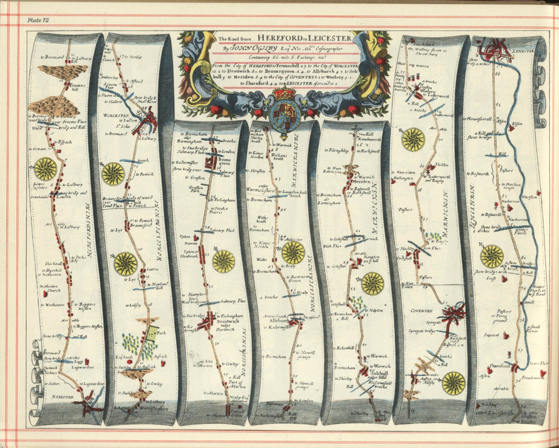
Strip maps such as those by John Ogilby are created to to chart roads and journeys, they are a perfect vehicle to convey a sense of travel and adventure for your players. These are both created using the Cartographer’s Annual Vol 3 Strip Map style.
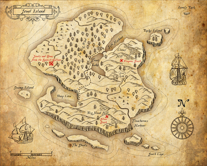
Perfect for Caribbean swashbucklers, use this style to map the hidden coves and tropical islands.
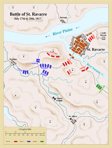
This style emulates classic deptictions of the battles fought in the Napoleonic wars of the late 18th and early 19th century. It is featured in The Cartographer’s Annual Vol 3.
This style from the Annual Vol 5 is based on the 1920s and 1930s Baedeker guides.
Also from the Annual Vol 5 is this matching street map style.
For overland maps in a 1930s style, there is this style from the Cartographer’s Annual Vol 7.
Comments Off on Historical Maps with CC3
ralf | May 8, 2014 | convention, germany, rpc
 After a one year hiatus, ProFantasy will be at RPC Germany again next weekend (May 10th and 11th). Meet us in Cologne, Messe Deuz, hall 5.2 on aisle B, booth 036.
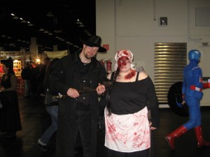 The RPC is a role-playing convention spanning various media, from computer games, via tabletop rpgs to live-action role-playing, and includes a renaissance fair (medieval market). One of its most striking aspects is the number of people in stunning costumes walking the halls.
We’ll have Symbol Set 4 – The Dungeons of Schley at the booth (fresh from the printers), as well as our other recent releases: Character Artist 3 and The Cartographer’s Annual Vol 7.
Comments Off on ProFantasy at RPC Germany in Cologne
Simon Rogers | April 14, 2014 | competition, dungeon
 To celebrate the release of The Dungeons of Schley, we’ve devised a competition. Create a small underground lair – a bandit hide out, a cave taken over by a dragon, a mine used as a cultist HQ. The whole area the map covers including map embelishments should be no more than about 100 m / 300 ft square. The best will win an unlimited patron license to all our cartography software forever; two runners up will receive vouchers.
- It can be in any style, past, modern or future.
- You have to create it with CC3, and any other ProFantasy map-making software you wish to use – annuals, symbols sets, whatever you like,
- It can include third-party art as symbols or fill styles long as that art is available for commercial use by anyone.
- You grant us permission to post the map online, though you retain all other rights.
- Only one entry per person
- The main prize is an unlimited patron license, and the two runners up will receive $100 vouchers.
- To submit, post your entry on this forum thread.
- Competition closes on 14th June 2014.
1 Comment
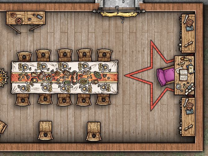
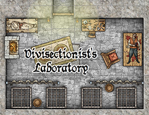
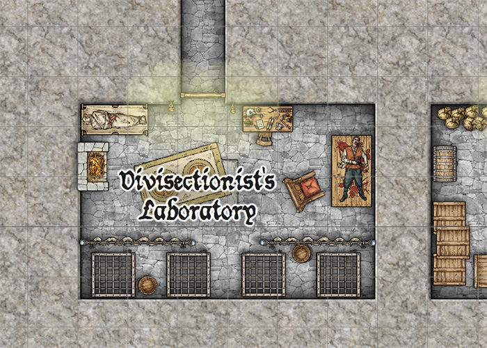
ralf | April 9, 2014 | dungeon, dungeons of schley, Floorplan, Mike Schley
 Need hidden depths? Have some of ours.
From the fiendish imagination of award-winning cartographer Mike Schley comes a whole new style of dungeon for Campaign Cartographer 3, featuring devious traps, lurking horrors, breath-taking hoards ancient architecture – Symbol Set 4: The Dungeons of Schley.
All users who have not opted-out have been sent a special offer. If you have not received your offer email, please contact support.
SS4 works seamlessly with Dungeon Designer 3, but can also be used on its own in CC3. It includes two complete drawing styles based on Mike Schley’s artwork, with over a thousand symbols, more than 100 texture, 350+ drawing tools, three example maps and a mapping guide on how to go about a Dungeon of Schley.
Check out the SS4 product pages for more information.
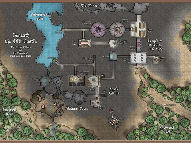
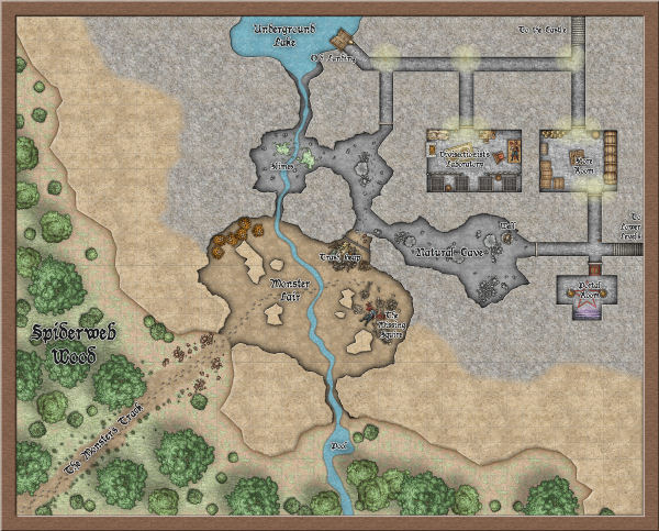
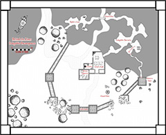
Beneath the Old Castle Example Map
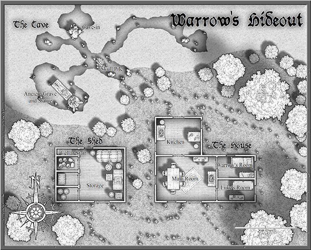
Warrow’s Hideout – Black and White Example Map
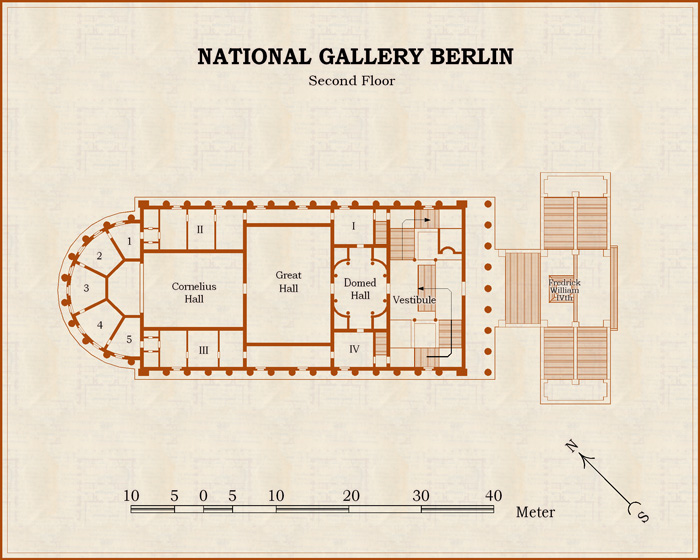
SS4 Symbol Detail
ralf | April 1, 2014 | Annual, competition
Following our map-making competition, we asked the winner Christian, whether he would allow us to transform his beautiful island map into a new style for the Annual. He happily obliged us, and the April issue is the result of that. Titled “Volcanic Islands” in honour of the competition, the style of course allows to draw all kinds of islands or regions and especially suited for small to mid-sized areas. Check out the example map on the right (click for an enlarged version).
The April Annual is now available from the registration page for current subscribers. If you haven’t subscribed yet, you’ll find more information on the Annual 2014 product page.
Comments Off on Cartographer’s Annual – April: Volcanic Islands
ralf | February 19, 2014 | Newsletter
 Dear Cartographers, welcome to the February newsletter!
News
Resources
- Check out The January collection of community maps, again including great artwork from our users.
- Download the Symbol Creation Guide for Character Artist 3. It provides a detailed tutorial on how to create and import your own bitmap symbols to use in CA3.
Map-making articles
Comments Off on February: Dungeons of Schley and Peacemakers
ralf | January 29, 2014 |
By TolrendorDM
In January last year I had the somewhat crazy idea of setting myself a target, which I named The Cartographer’s Annual Challenge. With each month’s issue of the 2013 subscription-based CC3 add-on I would produce a map, with the only real constraint being that the content had to relevant in some way to my home-brew D&D® world/campaign, which I call Tolrendor. Twelve months on, I am very pleased to have achieved this: you can see the results here.
The motivation for starting this Challenge was simple. I have been a subscriber to the Cartographer’s Annual since its inception in 2007, and although I realise that for readers of this blog I’m mostly preaching to the converted, I can’t recommend it highly enough. I’ve had CC3 for many years, but the reality is that it was only after the beginning of the Annuals, with their informative mapping guides and well-constructed style packs, that I really started to achieve map-making that I was proud of.
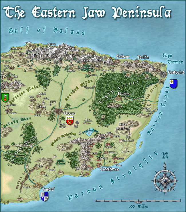
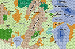 But here’s the thing! The actual number of Annual issues that I truly used was extremely low. Oh, I had my favourites, including the original hex mapping style from July 2010 (shown on the right), the Jon Roberts trio of styles, and the recent Pär Lindström regional style, but normally I simply enjoyed viewing the example images and reading the mapping guides. The Annual Challenge was deliberately designed to break that trend.
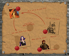 At times this content constraint turned into quite a challenge! The very first January issue was a style pack called ‘Investigation Props’, designed for modern/Cthulhu detective style games. How was I to use that for a fantasy setting? I had to rack my brain quite hard, but eventually came up with the idea of producing a handout as a pre-session recap. This proved quite timely, as my PCs were in the middle of a town-based adventure, and needed to remember the relationships between the important NPCs.
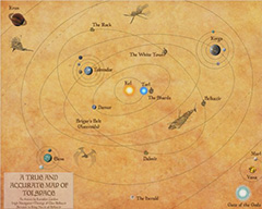 My favourite map of the whole Challenge also originated from an issue where I struggled for inspiration. The August issue was designed to depict science-fiction star systems. Beautiful example maps, but not fantasy. Then I remembered the old AD&D Spelljammer setting, one of my favourite alternate settings. After a quick rummage, I also unearthed a notebook of ancient (well 30 years old…) notes documenting the Tolrendor ‘Crystal Sphere’. So I used the basic style with its orbit drawing tools and planet symbols, but with a parchment background and some Spelljammer ships (added in Photoshop) to give a ‘fantasy space’ feel.
 There was a definite motivation behind the decision that each map had to be related to my D&D setting. I don’t get nearly enough mapping time as it is, so if I was going to spend the time on the Challenge, it made sense to create maps that would be used in my campaign.
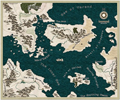
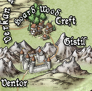
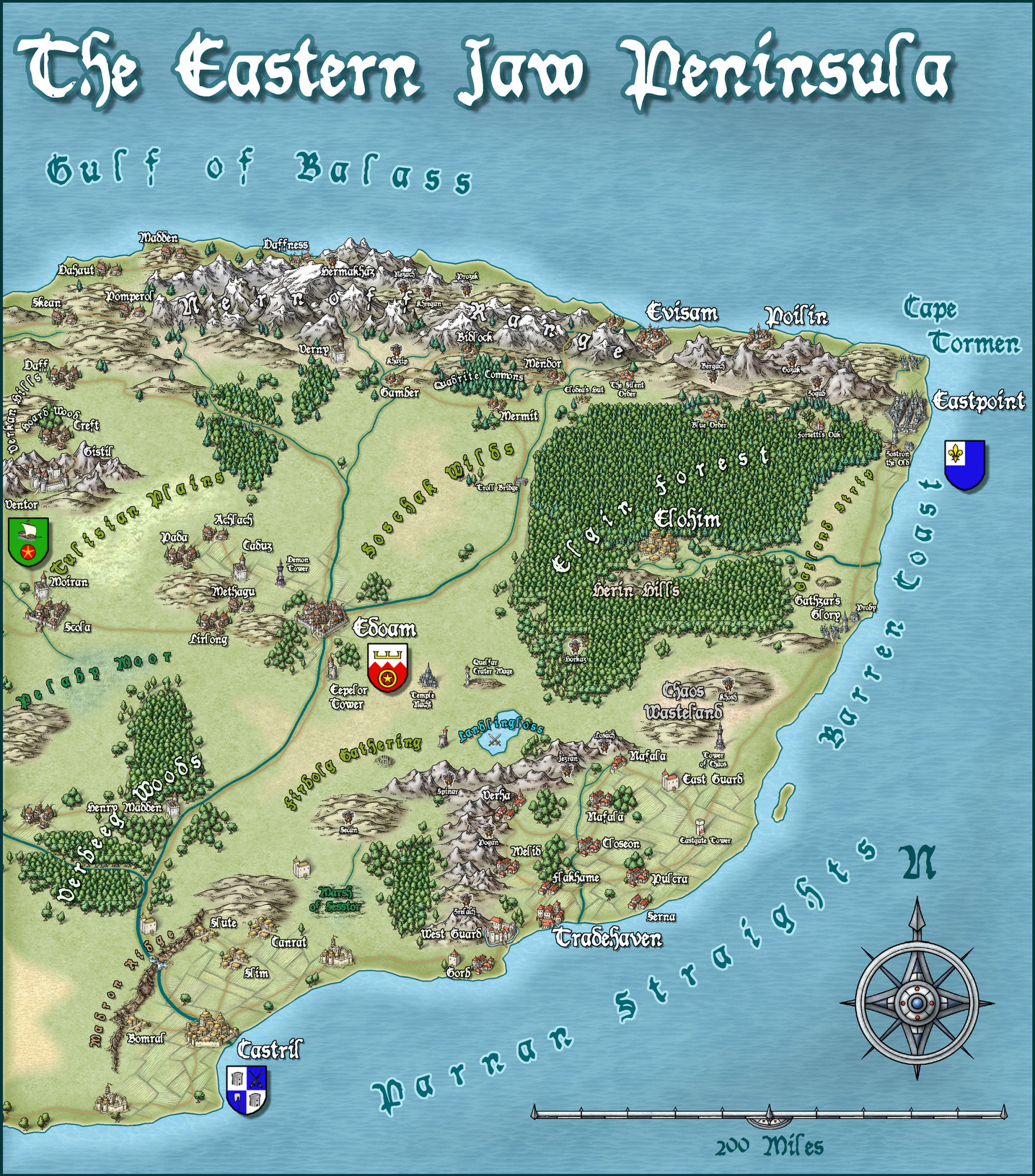
 This has been great fun, resulting in maps like this overland one, detailing an area of my world that had always been sketchy before (utilising the beautiful ‘DeRust’ symbols from the September issue), or this dungeon map for a new D&D® Next campaign (although it might be 13th Age now, but that’s another story…) using the black and white style from the October issue.
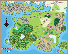 There was only one map, using the June issue, that broke these self-imposed rules, and that was simply because the style just cried out for it. My son has been drawing his own world, and when I showed him the example maps for this issue, he definitely wanted a ‘Scaryland’ version. This seemed a reasonable request, so I went with it. Besides, maybe one fine day explorers will find this ‘lost continent’ on the other side of Tolrendor.
The one thing I didn’t always (often didn’t…) achieve was my target of finishing each map within the same month that the issue was released. I managed quite well for the first four or five months, but the rest were done in ‘catch-up’ bursts throughout the rest of the year. It’s something I’ll have to try a bit harder on in 2014…
Yes, that’s right, I’ve decided to repeat the Cartographer’s Annual Challenge in 2014. I’ve really enjoyed setting myself targets for mapping and having to find some inspiration for each issue last year. My CC3 skills have improved out of sight, and my campaign has benefited greatly, so why not? My January effort is now finished, so I’m on the way.
So if you’re a Cartographer’s Annual subscriber, why don’t you join me in the Challenge … let’s all get mapping and sharing!
Article by Andrew Collett (TolrendorDM on the ProFantasy community forum)
1 Comment
ralf | January 16, 2014 | Newsletter
 Dear Cartographers, welcome to the January newsletter!
News
Resources
Map-Making Articles
Comments Off on January: Heroes and New Worlds
Simon Rogers | January 16, 2014 | competition, parton license
Create a map of an island, less than three miles wide. The prize? The best will win an unlimited patron license to all our cartography software forever.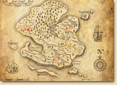
- It doesn’t have to feature treasure, and it can be in any style, past, modern or future.
- You don’t have to create it with CC3 but it must be originally created for this competition and not posted elsewhere.
- You grant us permission to post the map, though you retain all other rights
- Only one entry per person
- If there are more than three entries, and the winner is not an amateur, then there will be an additional prize (a voucher worth $100) to the best amateur.
- To submit, post your entry on this forum thread, or email us a file, no more than 2MB.
- Competition closes on 1st March 2014.
Good luck, cartographers!
3 Comments
Simon Rogers | January 16, 2014 |
We are very fortunate to have taken on Joe Slayton as a programmer for CC3+ work. From his free terrain general Wilbur, he created Fractal Terrains, now on its third version. You can get a better idea of his take on life and programming in this interview. He is a C and C++ expert and one of few people in the world who can work with the FastCAD code base and mass of additional code we’ve built up over the years. He’s already wowed our existing developers Mike Riddle and Peter Olsson with his innovative approach – doubling the speed of CC3+ effects just for a start. He’s also honed code which is tangled with age to make it more consistent and easy to read.
Using Joe’s Fractal Terrains 3 is more like exploring an apparently infinite set of worlds than creating them from scratch, and the process of discovery makes the imaginary worlds it creates makes them more real. Just for example, here is something I knocked out while playing with FT3 and exporting into CC3. It took about fifteen minutes. I used Ralf’s Jhendor colour scheme with Roughness, Percent Sea and Large Size sliders a little over to the right, and I spotted this rather appealing island. I added rivers at custom resolution, then a bevel and blur on the coast in CC3.
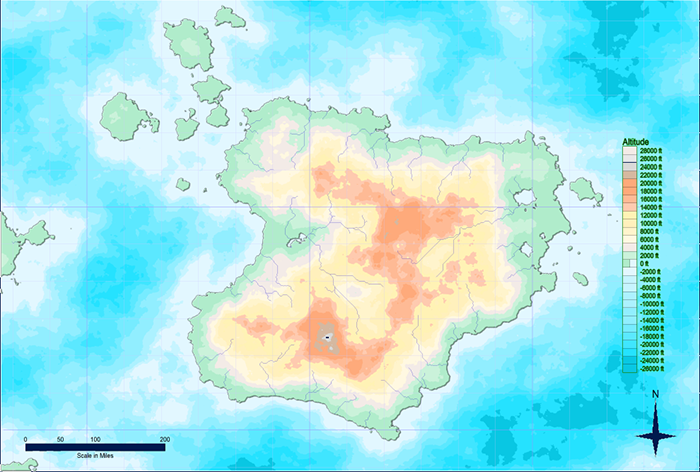
Ralf has also used FT3 to create a campaign world, Jhendor. Here is a sample output from FT3.
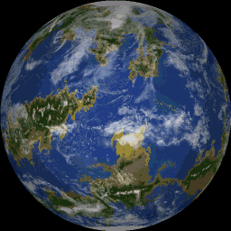
So, if you are interested in world building, exploring variations on the real universe, or just starting from a billiard ball you can try the demo here.
3 Comments