Simon Rogers | June 13, 2014 | Annual, city design, examples
You can create a wide range of cities and urban areas with CC3 and its add-ons and symbol sets. This article shows you a selection, and the software you need to create them.
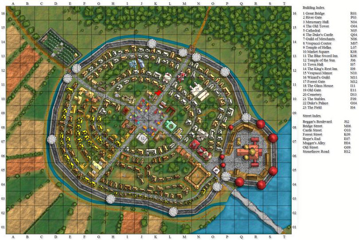
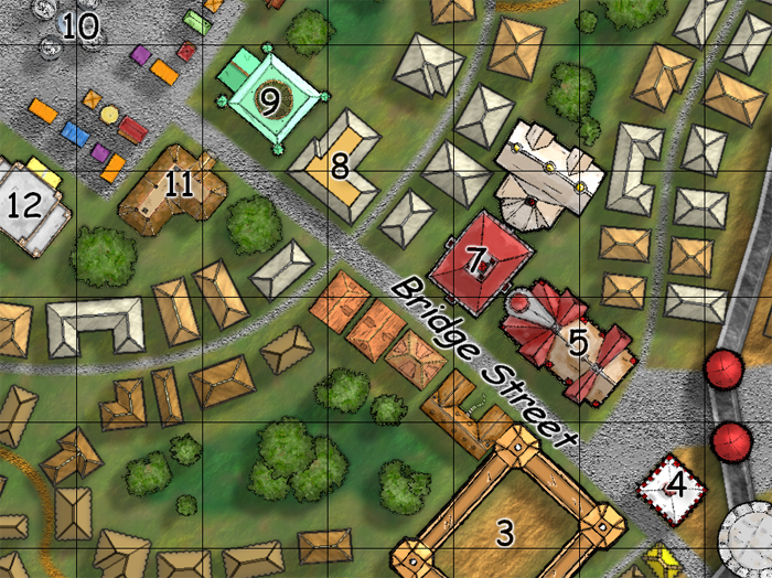
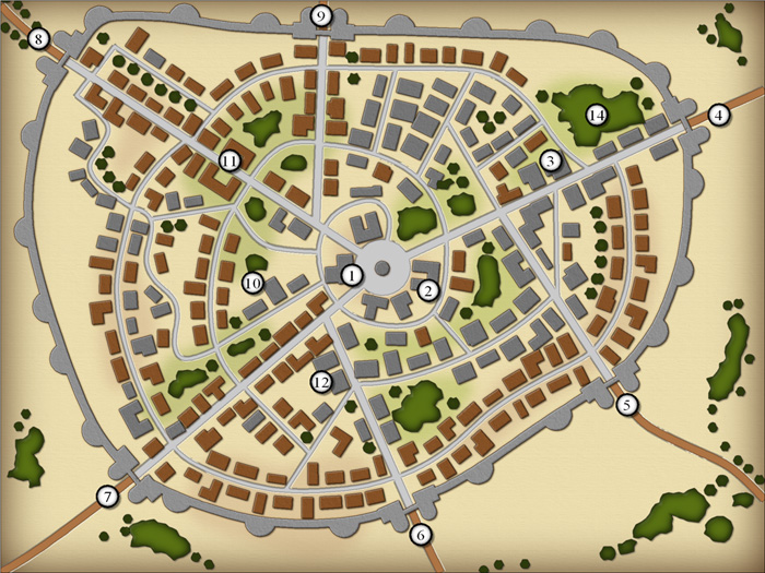
City Designer 3 is (unsurprisingly) the best resource for urban areas – the following examples were created with CD3.
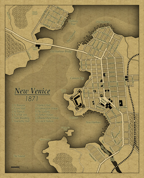
This is from the Annual Vol 5 – a 1930s style map.
a This map was created with the black and white city style released in the Annual Vol 4
Two styles in one, here in the Annual Vol 1. One is remininiscent of 18th to 19th century maps, while the second creates the look of contemporary street maps.
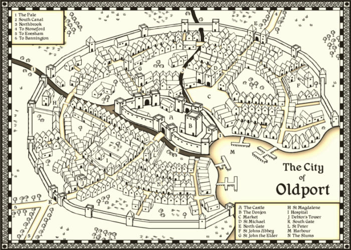
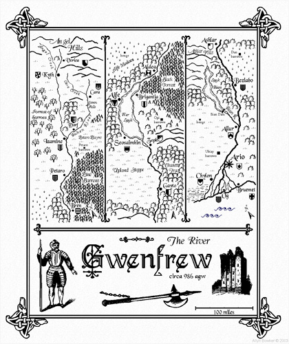
This map emulates the famous town and city maps of British cartographer John Speed (1542-1629). It was created with the John Speed City style from The Cartographer’s Annual Vol 1.
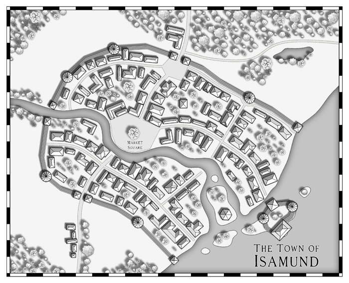
This style from the Annual Vol 3 does not require City Designer 3
Comments Off on Making City Maps with CC3
Simon Rogers | May 20, 2014 |
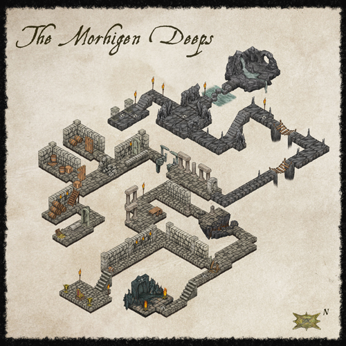
You can create a wide range of dungeons and floorplans with CC3 and its add-ons and symbol sets. This article shows you a selection, and the software you need to create them. Dungeon Designer 3, Symbol Set 2 and Symbol Set 4 have an extended set of dungeon symbols, the Annuals and CC3 have a more restricted selection.
While it’s featured in Cartographer’s Annual Vol 1, this inn is created with CC3 plus Dungeon Designer 3 (DD3).
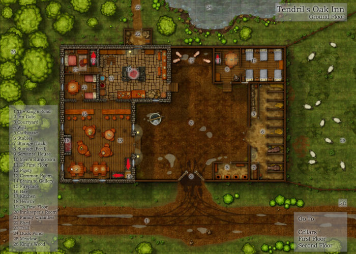
Tendrill’s Oak Inn – created with CC3 and DD3
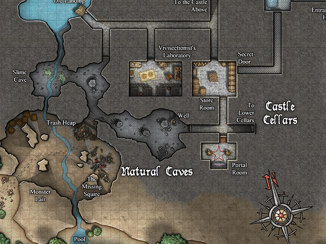
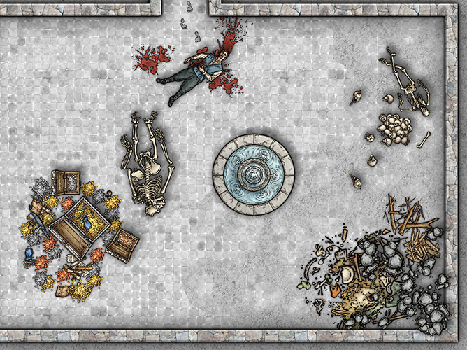
This next four images were created with Symbol Set 2: Fantasy Floorplans plus CC3.

Temple of the Fire Demon
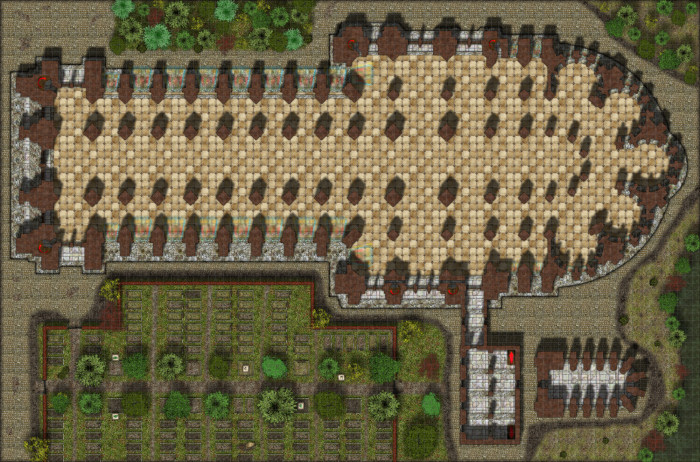
Gothic Cathedral
A close up of the cathedral.
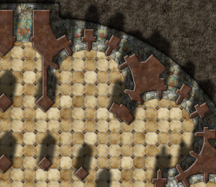
Cathedral Close-up
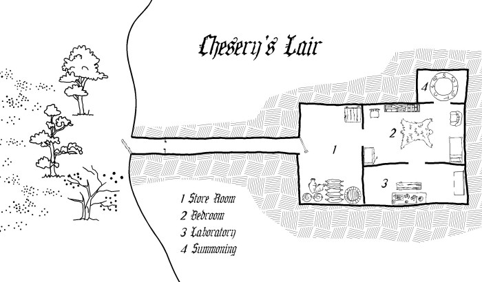
Chesery’s lair
Another black and white style created with CC3 plus Cartographer’s Annual Vol 4
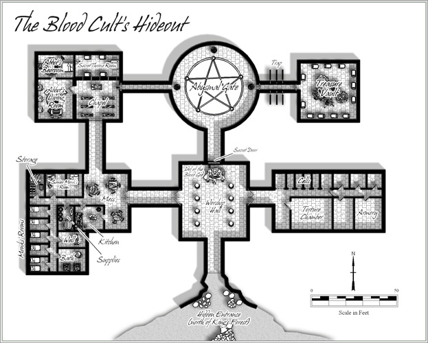
The Blood Cult’s Hideout
This map was created by master cartographer Jon Roberts using Cc3 with Cartographer’s Annual Vol 5.
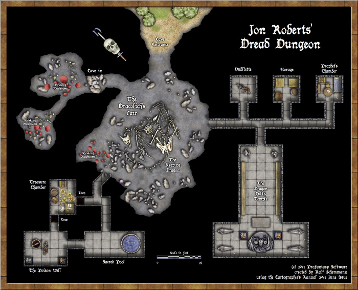
Jon Roberts Dungeons – Jon Roberts Dread Dungeon
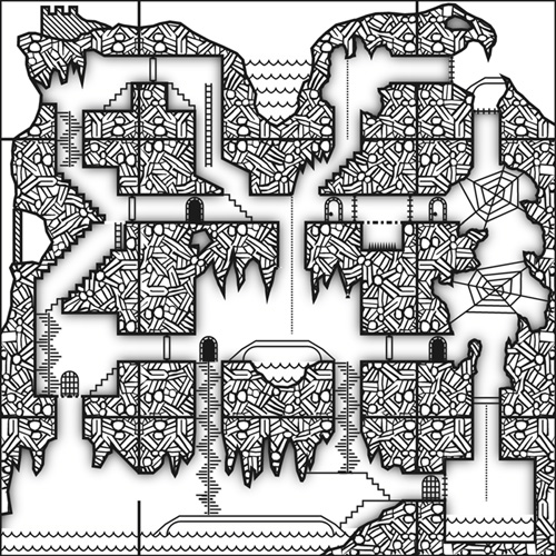
This vertical dungeon was created with Cc3 and Cartographer’s Annual Vol 5.
If you want 3D view, this amazing isometric view created by Herwin Wielink is for you.
Isometric Dungeon
Here are a selection of images from our latest and greatest symbol set – Symbol Set 4: The Dungeons of Schley.
Dungeons of Schley
Dungeons of Schley – Detail
And finally, for that old-school look we have the The Cartographer’s Annual Vol 1 style feature in “how to create a drawing style”
Old School Dungeon
Simon Rogers | May 19, 2014 | historical
ProFantasy’s Software allows you to create a wide array of maps in historical styles, from Mercator to medieval strip maps. This article shows examples and lets you know which software is required in addition to CC3 to create them.
If there are any historical styles you’d like us to match, let us know in the comments.
This Mercator-style map captures the flair and style of 16th and 17th century hand-coloured maps. Those centuries – the so-called “Age of Exploration” – were an era of immense European exploration and expansion and the art of cartography flourished to document and publish the newly discovered information on the shape of the world.
This map was created with the Mercator Historical Style from Annual Vol 1.

This map emulates the famous town and city maps of British cartographer John Speed (1542-1629). It was created with the John Speed City style from The Cartographer’s Annual Vol 1.
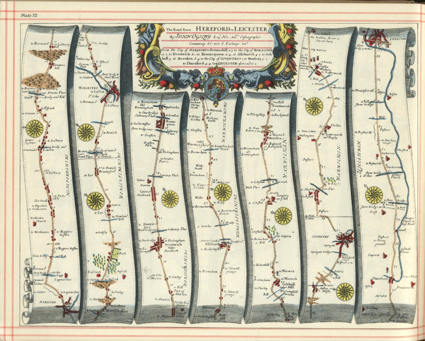
Strip maps such as those by John Ogilby are created to to chart roads and journeys, they are a perfect vehicle to convey a sense of travel and adventure for your players. These are both created using the Cartographer’s Annual Vol 3 Strip Map style.
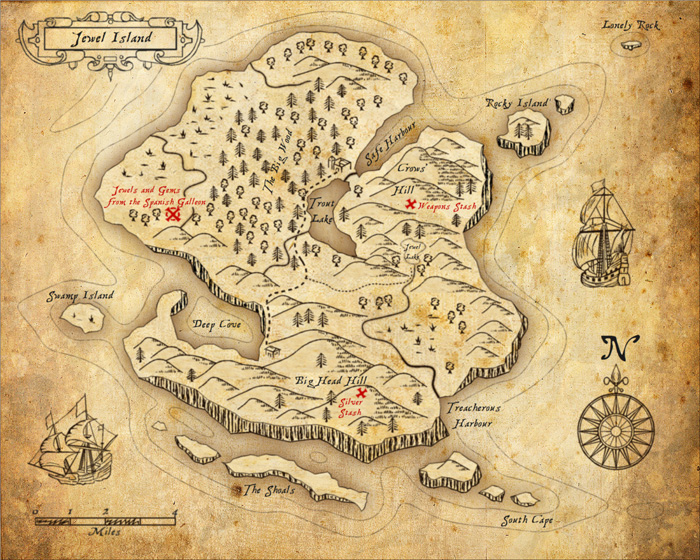
Perfect for Caribbean swashbucklers, use this style to map the hidden coves and tropical islands.
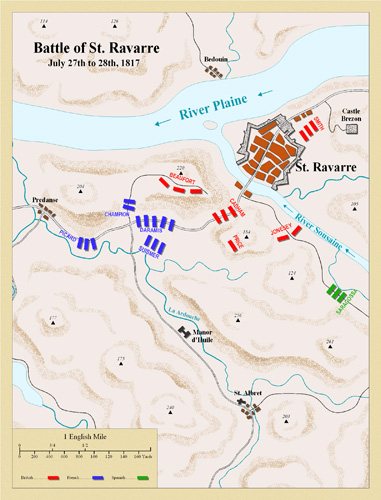
This style emulates classic deptictions of the battles fought in the Napoleonic wars of the late 18th and early 19th century. It is featured in The Cartographer’s Annual Vol 3.
This style from the Annual Vol 5 is based on the 1920s and 1930s Baedeker guides.
Also from the Annual Vol 5 is this matching street map style.
For overland maps in a 1930s style, there is this style from the Cartographer’s Annual Vol 7.
Comments Off on Historical Maps with CC3
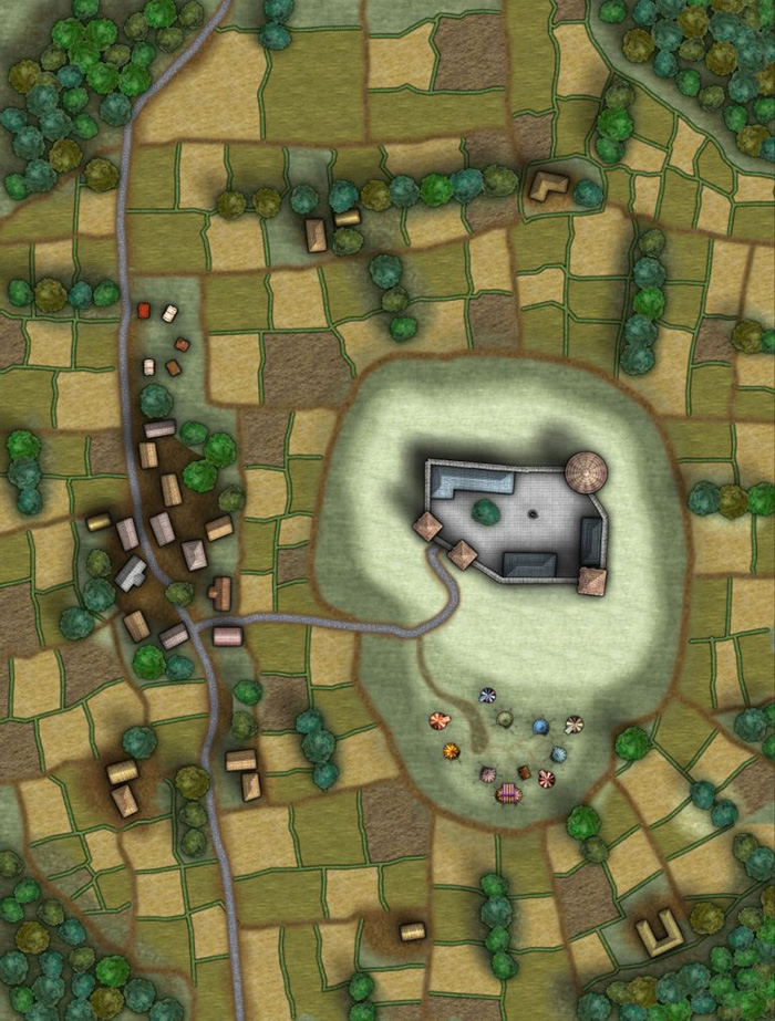
ralf | May 1, 2014 | MonkeyBlood, overland
 The May issue of the Annual 2014 contains an overland style by a new contributing artist: Glynn Seal of MonkeyBlood Design. We recently became aware of his beautiful Havenland set of symbols for overland maps, and luckily Glynn was more than willing to create a set for the Annual.
More than a hundred carefully crafted symbols and a complete set of bitmap textures make this style another great selection for your overland maps. As usual for the Annual, a mapping guide takes you through drawing a map in this style step by step.
The May Annual is now available from the registration page for current subscribers. If you haven’t subscribed yet, you’ll find more information on the Annual 2014 product page.
1 Comment
ralf | April 14, 2014 | books, world building
Author Nat Russo posted the following great article on “A Writer’s Journey” and graciously allowed us to repost it here. Enjoy his excellent advice and check out his book “Necromancer Awakening“.
Continue reading »
Comments Off on World Building Primer by Nat Russo
Simon Rogers | April 14, 2014 | books, overland maps
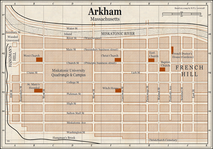
From Tolkien’s seminal Lord of the Rings, to Lord Foul’s Bane and Game of Thrones, blockbusting fantasy novels need maps you can flick back to when following the journeys of the protagonists. The Fantasy Reader blog provides an index with wide selection of examples.
Campaign Cartographer has been used to illustrate novels such as Shades of Gray by Lisanne Norman, Le Temple Des Eaux-Mortes by Eric Ferris, and Johannes Cabal the Detective by Jonathan L. Howard, and writer David Brown discusses his experience with CC3 here.
So, which are the best CC3 styles to use to sketch a world for your frontispiece? Most likely it’s black and white line are, though greyscale might work. Here are some suitable suggestions for overland maps.
This prosaically named Overland B&W style is a perfect example of a simple style with which you can create a first fantasy map, It’s very straightforward to use.
Annual 2008 Overland B&W Style
ralf | April 1, 2014 | Annual, competition
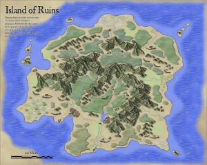
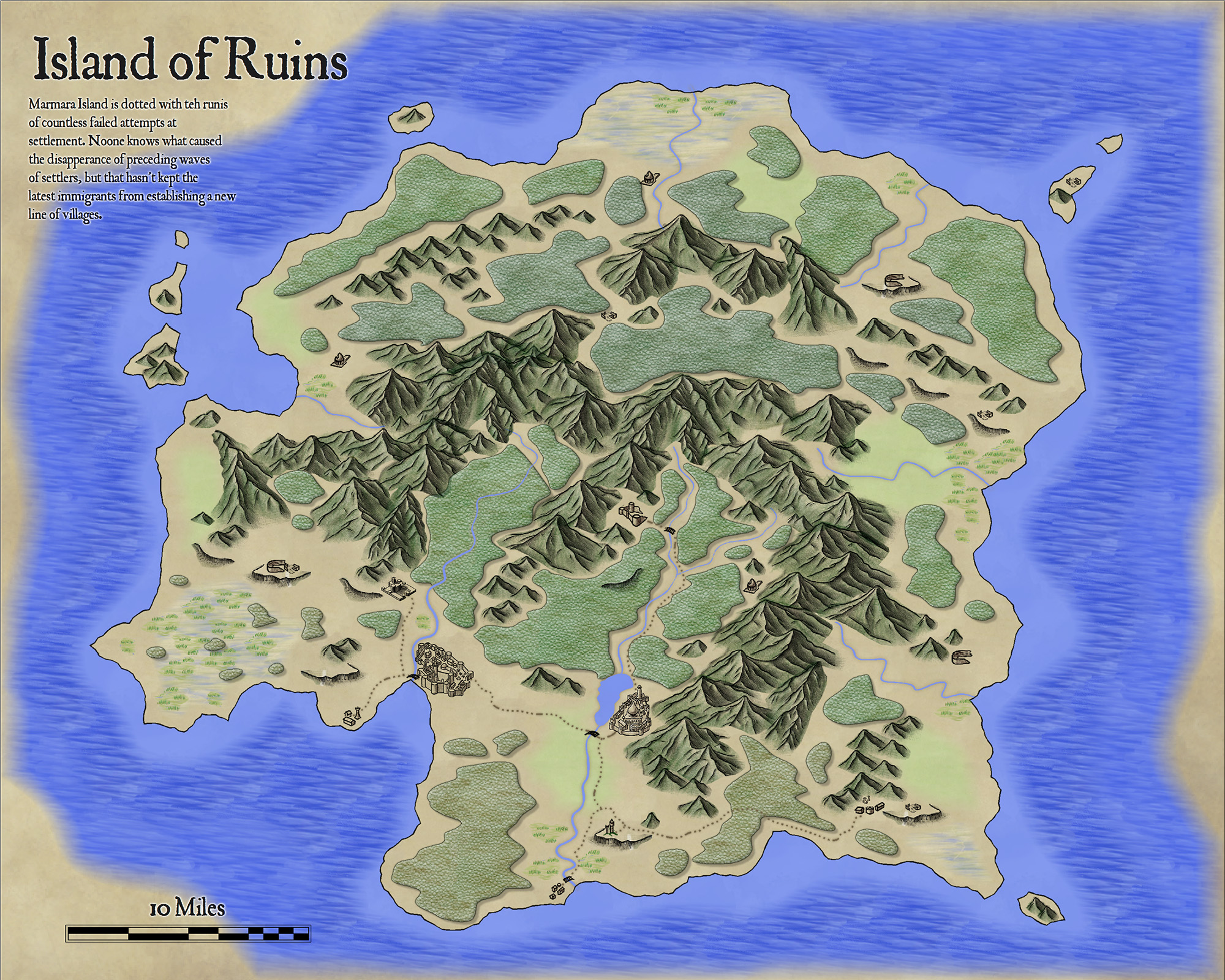
Following our map-making competition, we asked the winner Christian, whether he would allow us to transform his beautiful island map into a new style for the Annual. He happily obliged us, and the April issue is the result of that. Titled “Volcanic Islands” in honour of the competition, the style of course allows to draw all kinds of islands or regions and especially suited for small to mid-sized areas. Check out the example map on the right (click for an enlarged version).
The April Annual is now available from the registration page for current subscribers. If you haven’t subscribed yet, you’ll find more information on the Annual 2014 product page.
Comments Off on Cartographer’s Annual – April: Volcanic Islands
ralf | March 19, 2014 | competition, user maps
We’ve asked Christian, the winner of our map-making competition, to share a few words on his map and the competition and he was so kind to oblige. Here’s what he has to say.
* * * * *
A few weeks ago I was searching online for fantasy map-making contests. I wanted an assigned theme and a real deadline—something that would challenge my skills and help me generate another piece of work I could be proud of. That’s when I came across ProFantasy.com. I’d been interested in their software before, but hadn’t had a chance to use it. Now I had a chance to win it in a competition.
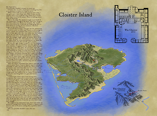
Make an island, they said, about three miles across. Something like a medieval treasure map. The contest had been open for months, but was closing in just a few days. I took a look at the submissions that had been sent in thus far, decided I had a shot at winning, and threw myself into it.
I worked feverishly, right up to the deadline, and actually ran out of time to put absolutely everything I wanted into the map. That’s why there’s no border around it, and no compass rose… But what I did manage to produce followed my vision. As a novelist and dungeon master, I knew I could create some storytelling elements that would hook into the drawing. Some secrets and clues that would only be available to those who looked closely, and a narrative that would marry the image to the text. I had an aesthetic that I’d been developing for maps for my novels, inspired by some of the top fantasy cartographers online. I’m passionate about making beautiful illustrations, and I’m excited to be learning new techniques every day.
 * * * * *
As for the hands-on process itself, virtually all of this map was hand-drawn in ProCreate on an iPad 3 using an Adonit Touch stylus. There are a few “pattern brushes” in that app which help with things like the the jungle trees and the ocean waves, but everything else was the result of pushing pixels manually. The shape of the island and mountains isn’t based on anything other than doodling with the idea of a vaguely volcanic tropical island in mind.
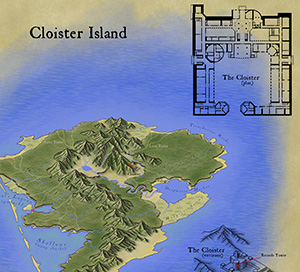
The cloister overhead plan was laid out in Adobe Illustrator. It’s far larger, sharper, and more detailed in the original file, with many upper floors and basement dungeon levels. The “3D” isometric extrusion of the cloister is actually just faux-3D, a technique I use in Illustrator where I take the overhead plan and rotate, squash, duplicate and move by a certain amount, and then blend. I took a screen shot of that and traced over it in ProCreate.
The last step was to bring it all into Adobe Photoshop. I had created a “parchment background” from some rendered clouds and a bunch of filters, so I laid out the various pieces on that background and added the text elements. Then I did save-for-web and picked settings that looked good but kept the resulting file under 2 MB.
The cloister itself is about 300 feet on one axis, making the hypotenuse around 500 feet. Since you can line up 30 of the little cloister images end to end and have them stretch from one side of the island to the other, the island winds up being about 3 miles across.
1 Comment
ralf | March 10, 2014 | competition
As we wanted to be as impartial as possible, we’ve asked fantasy cartographer Mike Schley to be the judge for our January competition. He took his job very seriously and came back to us with the following results:
First, I would like to thank Profantasy for inviting me to serve as judge for this mapping challenge. When approached by Simon to decide the results of this competition I jumped at the chance. Then, upon seeing the work, I realized how difficult the task would be. Assessing each entry in a logical manner and narrowing the field to two pieces would require making tough choices on the narrowest of margins.
My methodology for examining the submissions came directly from my own cartographic practice and relied on the three criteria by which I judge my own work. These measures include aesthetic appeal/creativity, visual readability, and usefulness of the information provided. Given the straightforward parameters set down for the competition, “create a map of an island, less than three miles wide” scoring the entries by these criteria made for a process that, though difficult, was fairly straightforward and analytical.
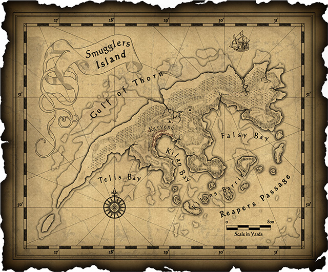
So without further delay, the winner is… entry #17 Cloister Island, followed closely by the runner up, entry #15 Smugglers’ Island.
Of all the submissions, I felt that the Cloister Island map functioned best as both a visual information system and an inspiring illustration of its setting. Even though the cartographer left off a compass rose and scale bar, the overall work felt the most coherent and provided numerous levels of information. Like an onion, the island and story revealed themselves in layers, giving the reader an opportunity to explore deeper and deeper into an immersive world. On top of this, I’m a sucker for hand drawn isometric maps.
Choosing a runner up was probably the hardest part of the job since there were a number of maps that I felt had quite a lot going for them. I selected Smugglers’ Island mainly because it’s design and presentation of information felt more unified than the other entries. The visual details work well together and the cartographer’s choice of font, embellishments, and patterning add up to a striking, if somewhat cluttered, image.
Finally, I would like to thank everyone that contributed work to the competition and encourage them to keep at it. Designing worlds is something dear to my heart and it was a joy to see so many thoughtful approaches to the assignment.
Sincerely,
Mike Schley
So the winner of the competition and the new holder a full ProFantasy Patron License is xianpryde. Congratulations!
The runner-up, dfahr, receives a ProFantasy store voucher worth $100. Also congratulations.
And thanks to everybody for their submissions. Your work was all wonderful!
Comments Off on And the winner is…
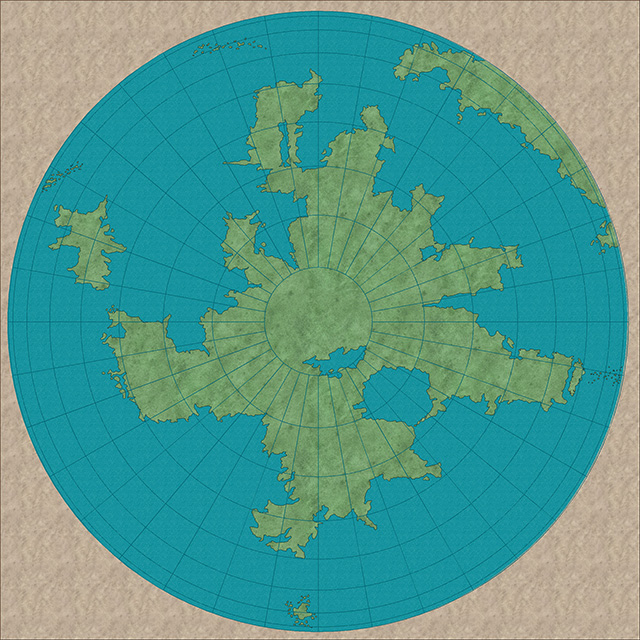
ralf | March 3, 2014 | Annual, cartography, map projections, overland
Interested in the history of cartography and the quest of mapping the earth’s globe on a flat piece of paper? Want your imaginary world to have a touch of realism or believability? Than the March Annual issue is for you. Check out more than a dozen new templates, showing different map projections, and instructions on how to convert these into your favorite mapping style.
If you are an Annual subscriber, log into your registration page to download it. If not, you can subscribe to the Cartographer’s Annual 2014 here.
Comments Off on Cartographer’s Annual – March: Map Projection Templates
