ralf | July 2, 2017 | Annual, historical, Mercator, overland
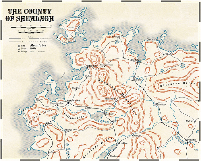
 This month we go back to the very first drawing style every created for the Cartographer’s Annual: The Mercator Historical overland style, originally published in January 2007. Yikes! Has it really been that long?
Why are we doing that? Since the 2017 Annual has recently been updated, the Mercator style is already available for CC3+ after all? Well, it gives us the opportunity to do two major things: First, we can significantly expand the range of symbols available for the style. Second, we can update the documentation (i.e. the mapping guide) to take more of the CC3+ features into account. And we make this beautiful style available for everyone who doesn’t own the Annual Volume 1 yet.
For those who don’t know the style yet, it is based on the works of 16th and 17th century cartographers, and captures the flair of early exploration and the wonders of Terra Incognita – the Unknown Land.
The issue is now available for CC3+ from the registration page for all subscribers. If you haven’t subscribed to the Annual 2017 yet, you can do so here.
Comments Off on Cartogapher’s Annual: July 2017
ralf | July 1, 2014 | historical, overland, worthington
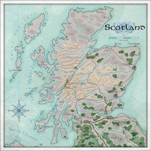 The July Annual introduces a new contributor to our subscription: Steff Worthington, who’s beautiful map artwork you can peruse on his WordPress page.
Inspired by one of his maps – a depiction of Athurian quasi-historical Britain – the style produces clear, legible and very beautiful maps. They are based on a selection of bitmap textures, accentuated by a small selection of symbols and careful text labelling. Take a look at the example map of Scotland (done in CC3) shown here and compare it to Steff’s original artwork.
As a subscriber you can download the June Annual issue from your registration page. If you haven’t subscribed to the Annual 2014, you can do so here.
Comments Off on Cartographer’s Annual – July: Worthington Historical Maps
Simon Rogers | May 19, 2014 | historical
ProFantasy’s Software allows you to create a wide array of maps in historical styles, from Mercator to medieval strip maps. This article shows examples and lets you know which software is required in addition to CC3 to create them.
If there are any historical styles you’d like us to match, let us know in the comments.
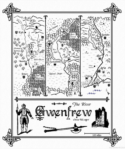
This Mercator-style map captures the flair and style of 16th and 17th century hand-coloured maps. Those centuries – the so-called “Age of Exploration” – were an era of immense European exploration and expansion and the art of cartography flourished to document and publish the newly discovered information on the shape of the world.
This map was created with the Mercator Historical Style from Annual Vol 1.

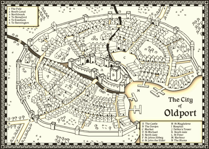
This map emulates the famous town and city maps of British cartographer John Speed (1542-1629). It was created with the John Speed City style from The Cartographer’s Annual Vol 1.
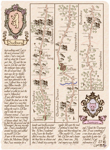
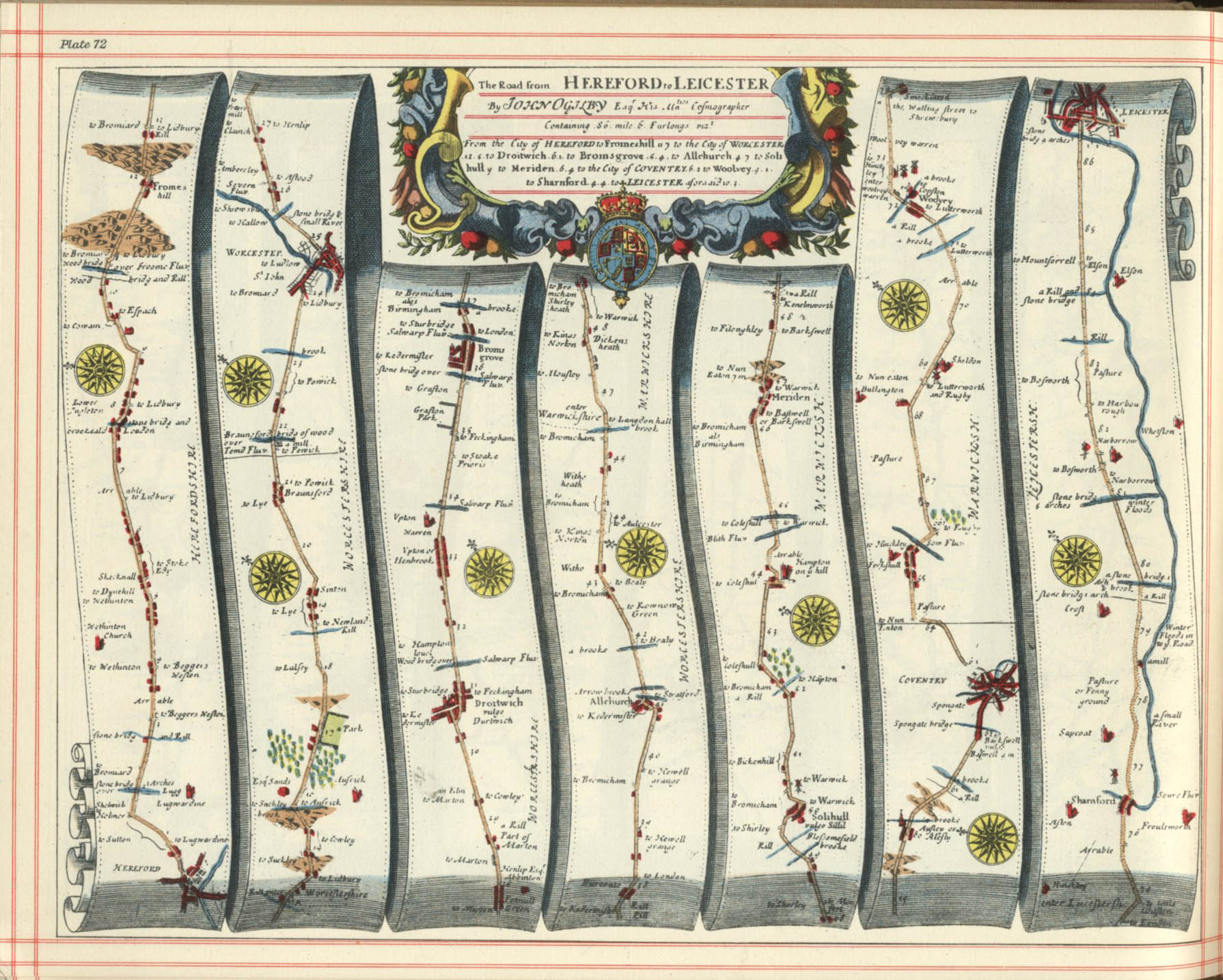
Strip maps such as those by John Ogilby are created to to chart roads and journeys, they are a perfect vehicle to convey a sense of travel and adventure for your players. These are both created using the Cartographer’s Annual Vol 3 Strip Map style.
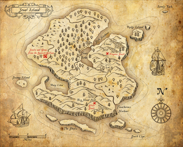
Perfect for Caribbean swashbucklers, use this style to map the hidden coves and tropical islands.
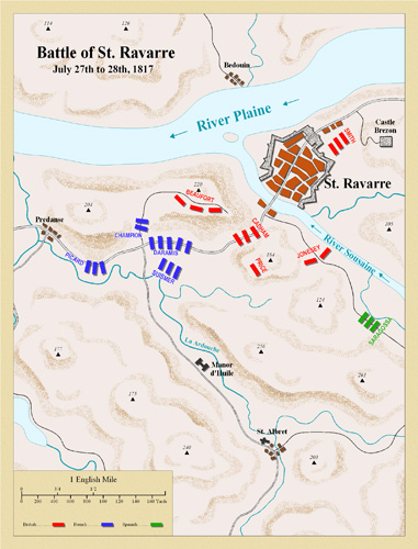
This style emulates classic deptictions of the battles fought in the Napoleonic wars of the late 18th and early 19th century. It is featured in The Cartographer’s Annual Vol 3.
This style from the Annual Vol 5 is based on the 1920s and 1930s Baedeker guides.
Also from the Annual Vol 5 is this matching street map style.
For overland maps in a 1930s style, there is this style from the Cartographer’s Annual Vol 7.
Comments Off on Historical Maps with CC3
 This month we go back to the very first drawing style every created for the Cartographer’s Annual: The Mercator Historical overland style, originally published in January 2007. Yikes! Has it really been that long?
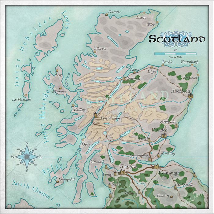